EditorialThe search was prompted by the discovery of a map drawn by a German soldier in 1945 marking the site where he had seen others bury stolen goods. (Ilvy Njiokiktjien/The New York Times)
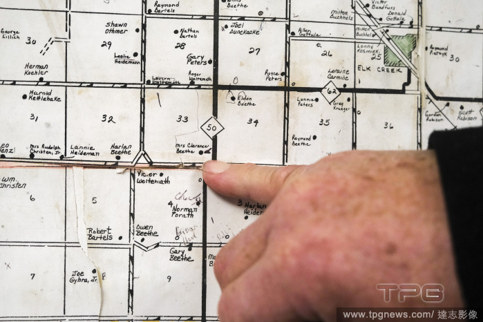
EditorialLavon Heidemann, a NioCorp spokesman, shows the location of a mining site at Beverly Beethe?s property on a map, at the Frontier Cooperative in Elk Creek, Neb., on Dec. 8, 2022. (Arin Yoon/The New York Times)
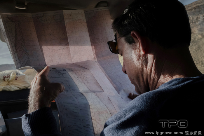
EditorialShahar Shilo, a researcher and expert in desert tourism, looks over a map of the area, in the Negev Desert in southern Israel, Dec. 21, 2021. (Amit Elkayam/The New York Times)
EditorialAn Israeli holds a coin from the Byzantine period at an excavation site in the Old City of Jerusalem, Old City Jerusalem, Israel - 10 Feb 2010
EditorialA close-up of a replica of the famed Madaba Map of the Holy Land is displayed in the Old City of Jerusalem, Old City Jerusalem, Israel - 10 Feb 2010
EditorialIncubated flamingo eggs hatch at ZSL Whipsnade ZooZookeepers at ZSL Whipsnade Zoo are celebrating the arrival of four, fluffy, flamingo chicks, after the eggs spent a month in an incubator to ensure their survival.
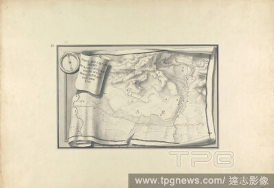
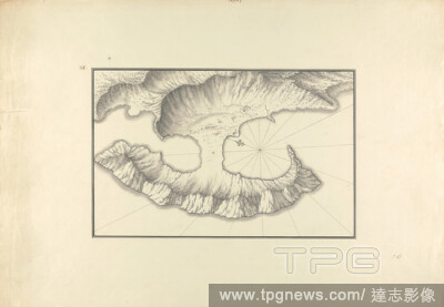
EditorialPlan of Lake Tiberias, Giovanni Battista Borra, 17131770, Italian, ca. 1750, Black ink with gray wash over graphite on moderately thick, moderately textured, beige laid paper, Sheet: 14 13/16 x 21 7/16 inches (37.7 x 54.5 cm) and Image: 9 1/4 x 14 7/16...
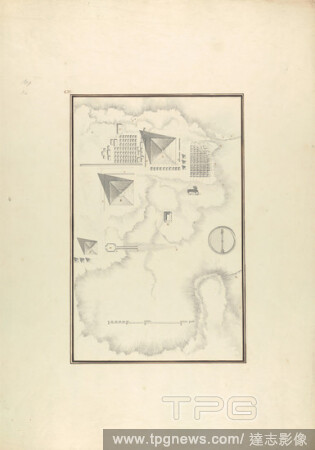
EditorialTopographical View of the Pyramids at Giza, Giovanni Battista Borra, 17131770, Italian, ca. 1750, Gray wash with black and brown ink over graphite on moderately thick, moderately textured, beige laid paper, Sheet: 21 1/4 x 14 15/16 inches (53.9 x 37.9 ...
EditorialPlan of the Ruins at Sardis with Vestiges of Ancient Buildings Still Existing in 1750, Giovanni Battista Borra, 17131770, Italian, ca. 1750, Black ink and gray wash over graphite on moderately thick, moderately textured, beige laid paper, Sheet: 15 x 2...
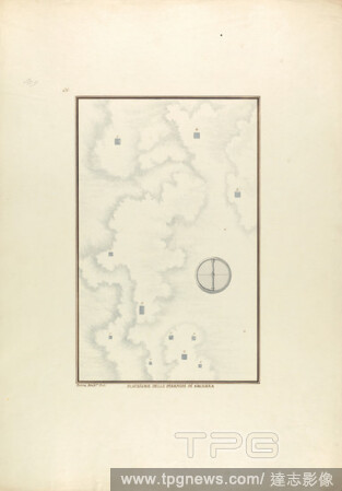
EditorialPosizione delle Piramidi di Sachara, Giovanni Battista Borra, 17131770, Italian, ca. 1750, Gray and brown ink with gray wash over graphite on moderately thick, moderately textured, beige laid paper, Sheet: 21 5/16 x 14 15/16 inches (54.1 x 38 cm) and I...
EditorialCnidus: Plan of the Harbor and Map of Sites, Giovanni Battista Borra, 17131770, Italian, ca. 1750, Black ink with gray wash over graphite on moderately thick, moderately textured, beige laid paper, Sheet: 14 5/8 x 21 1/4 inches (37.2 x 53.9 cm) and Ima...
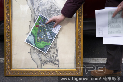
EditorialLinda Mead, president of land trust D&R Greenway, compares a current satellite image of Point Breeze, a 60-acre estate that was built by Napoleon Bonaparte?s older brother Joseph, with a reproduction of a map of the area from the 1800s, in Bordentown, N.J., Jan. 15, 2021. (Rachel Wisniewski/The New York Times)
EditorialLinda Mead, president of land trust D&R Greenway, compares a current satellite image of Point Breeze, a 60-acre estate that was built by Napoleon Bonaparte?s older brother Joseph, with a reproduction of a map of the area from the 1800s, in Bordentown, N.J., Jan. 15, 2021. (Rachel Wisniewski/The New York Times)
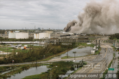
EditorialA fire burns at a BioLab industrial site in Westlake, La., near Lake Charles, on Thursday, Aug. 27, 2020, after Hurricane Laura passed through the region. (William Widmer/The New York Times)
EditorialJeffrey Shanks indicates on a Lidar map a a suspected Native American burial site in Gulf Breeze, Fla., Feb. 24, 2020. (Emily Kask/The New York Times)
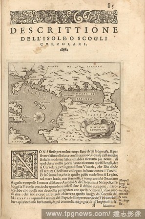
EditorialThe site of Curzolari, Map of Echinades and Gulf of Patra, Fig. 19, p. 85, Porro, Girolamo (ill.), 1575, Thomaso Porcacchi, Girolamo Porro: L' isole piu famose del mondo. Il secondo libro. In Venetia: apresso gli Heredi di Simon Galignani, 1590.
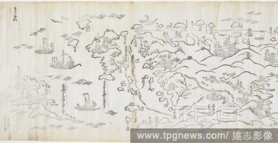
EditorialSea route from Hirado to Osaka, Japan. Shokoku kairiku anken zu [=Map of the Sea Route through Various Provinces]. c.1680-90. One of a pair of scrolls showing the sea route from Edo to Nagasaki. This section shows Hirado site of the English trading pos...
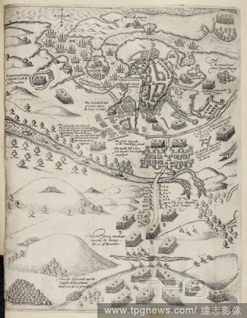
EditorialMap illustration of army besieging Kinsale in Ireland in 1601. Battle site. . The Army of the Kinge of Spayne commanded by Don John de Aguila besieged in the towne of Kinsale. London : A. Mathewes for R. Milbourne, 1633. Source: 186.d.8 Last folded map...
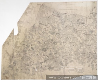
EditorialNewmarket. Even before horse racing became one of Newmarket's attractions under James I, Chevely Park at the top of this plan was famous for horse breeding. When this map was drawn, the Duke of Rutland had just taken possession of the park where he con...


 Loading